


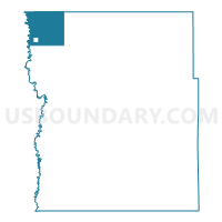
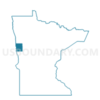
Georgetown Twp. Voting District, Clay County, Minnesota
About
Outline

Summary
| Unique Area Identifier | 601533 |
| Name | Georgetown Twp. Voting District |
| County | Clay County |
| State | Minnesota |
| Area (square miles) | 36.83 |
| Land Area (square miles) | 36.83 |
| Water Area (square miles) | 0.00 |
| % of Land Area | 100.00 |
| % of Water Area | 0.00 |
| Latitude of the Internal Point | 47.11471510 |
| Longtitude of the Internal Point | -96.76439830 |
Maps

Graphs
Select a template below for downloading or customizing gragh for Georgetown Twp. Voting District, Clay County, Minnesota


Neighbors
Neighoring Voting District (by Name) Neighboring Voting District on the Map
- Cass Precinct 20-02, Cass County, ND
- Georgetown Voting District, Clay County, MN
- Kragnes Twp. Voting District, Clay County, MN
- Lee Twp. Voting District, Norman County, MN
- Mary Twp. Voting District, Norman County, MN
- Morken Twp. Voting District, Clay County, MN
- Viding Twp. Voting District, Clay County, MN
Top 10 Neighboring County Subdivision (by Population) Neighboring County Subdivision on the Map
- Kragnes township, Clay County, MN (293)
- Morken township, Clay County, MN (156)
- Georgetown township, Clay County, MN (156)
- Georgetown city, Clay County, MN (129)
- Lee township, Norman County, MN (128)
- Viding township, Clay County, MN (103)
- Wiser township, Cass County, ND (88)
- Mary township, Norman County, MN (83)
- Noble township, Cass County, ND (74)
Top 10 Neighboring Place (by Population) Neighboring Place on the Map
Top 10 Neighboring Unified School District (by Population) Neighboring Unified School District on the Map
- Moorhead Public School District, MN (42,969)
- Dilworth-Glyndon-Felton School District, MN (6,082)
- Ada-Borup Public School District, MN (2,661)
- Northern Cass Public School District 97, ND (2,291)
- Norman County West School District, MN (1,472)
Top 10 Neighboring State Legislative District Lower Chamber (by Population) Neighboring State Legislative District Lower Chamber on the Map
- State House District 9A, MN (42,418)
- State House District 2A, MN (37,063)
- State House District 20, ND (12,348)
Top 10 Neighboring State Legislative District Upper Chamber (by Population) Neighboring State Legislative District Upper Chamber on the Map
- State Senate District 9, MN (81,765)
- State Senate District 2, MN (76,807)
- State Senate District 20, ND (12,348)
Top 10 Neighboring 111th Congressional District (by Population) Neighboring 111th Congressional District on the Map
Top 10 Neighboring Census Tract (by Population) Neighboring Census Tract on the Map
- Census Tract 402, Cass County, ND (2,291)
- Census Tract 9603, Norman County, MN (2,191)
- Census Tract 9602, Norman County, MN (1,901)
- Census Tract 301.07, Clay County, MN (1,729)